The Fergana Valley: Food Bowl of Central Asia

Ferghana Valley Uzbekistan
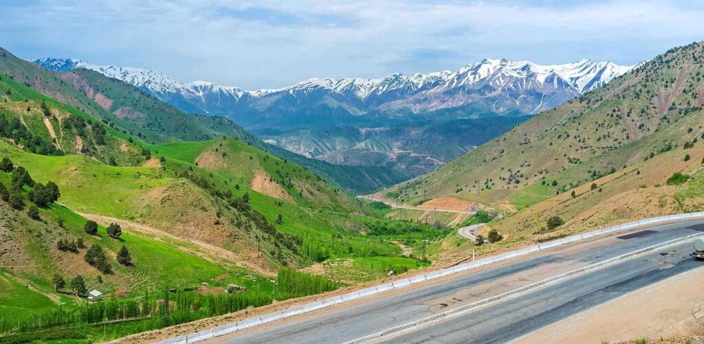
Fergana Valley located in Central Asia’s southeast corner. It is enclosed by the Tian Shan Mountains to the north and the Gissar-Alai range to the south. The valley’s approximately 22,000 square kilometers (almost 8,500 square miles) of flat plains distinguishes it from surrounding regions in Central Asia where the terrain is made up of mountains, deserts and treeless steppes.
Today Fergana Valley region is split between three countries of Central Asia that are Kyrgyzstan, Uzbekistan and Tajikistan and located on the Northern Silk Road; the Fergana played a significant part in the flowering of medieval Central Asian Islam.
Motherland of Babur
It is motherland of Babur a famous conqueror and founder of the Mughal dynasty in South Asia (Today’s Afghanistan, Pakistan, India and Bangladesh).
Fergana valley famous cities includes Andijan, Fergana, Kokand and Namangan from Uzbekistan, Batken, Osh and Jalalabad from Kyrgyzstan while Khujand from Tajikistan.
The valley is agricultural heartland of Central Asia
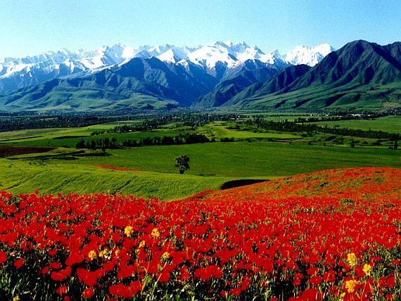
It is also prominent for its agricultural fertility, because of the Syr Darya River and its numerous tributaries. The Fergana Valley is a chief source of food for middle Asia. Its essential products include wheat, cotton, rice, vegetables and fruits.
Besides its beauty and abundant natural endowments, nothing about the Fergana valley is simple. For one thing, it is not a linear valley defined by rivers, although it roughly corresponds to the basins of the lower Naryn and Kara Darya rivers and their confluence to form the Syr Darya River. Rather, it is a large and roughly oblong flatland defined by no fewer than five chains of surrounding mountains, the Kuramin, Chatkal, Alai, Fergana, and Turkestan ranges.
The distance from north to south is about 100 kilometers, while east to west it measures approximately 300 kilometers at its widest. On a very clear day between late October and April one can stand in the middle of this valley and see snow-capped mountains on the horizon in every direction. Another distinctive feature of the valley is that its name is not really Ferghana, or Fergana (forms that date from Russian colonial rule), but Farghona.
However, given that the term Ferghana or Fergana has gained common usage we will use it, while acknowledging that a different name prevails locally. Either way, the single name suggests a degree of uniformity or unity that does not exist.
For most of its history, the Fergana Valley existed under a unified political entity. In the ancient era, it was a part of Transoxiana, a province of the Persian Empire, where it played an important role in the Silk Road trade from China to the Middle East and Europe. In the 13th century it came under the conquest of the Mongols and was incorporated into the Chagatai Khanate. Political boundaries shifted as Turkic groups and Islam spread into the region, but Fergana valley was always administered as a single unit. In the 18th century, this took the form of the Kokand Khanate, which included eastern Uzbekistan, Southern Kazakhstan, and most of Kyrgyzstan and Tajikistan.
The penetration of Imperial Russia into Central Asia in the 19th century once again shifted political control in the region. But the Fergana Valley remained intact, shifting to the Fergana province of Russian Turkestan out of the former Kokand Khanate in 1876.
In Tuzk-e-Baburi Babur defines Fergana:
On the east it has Kashghar; on the west, Samarkand; on the south, the mountains of the Badakhshan border; on the north, though in former times there must have been towns such as Almaligh, Almatu and Yangi. At the present time all is desolate, no settled population whatever remaining, because of the Moghuls and the Uzbeks.
Babur further describes: Fergana is a small country, abounding in grain and fruits. It is girt round by mountains except on the west, i.e. towards Khujand and Samarkand, and in winter an enemy can enter only on that side. The Saihun River commonly known as the Water of Khujand, comes into the country from the northeast, flows westward through it and after passing along the north of Khujand and the south of Fanakat, now known as Shahrukhiya, turns directly north and goes to Turkistan. It does not join any sea but sinks into the sands, a considerable distance below [the town of] Turkistan. Fergana has seven separate townships, five on the south and two on the north of the Saihun.
One of those on the south is Andijan, which has a central position and is the capital of the Fergana country. It produces much grain, fruits in abundance, excellent grapes and melons. In the melon season, it is not customary to sell them out at the fields. There are no pears better than those of Andijan. After Samarkand and Kesh, the fort of Andijan is the largest in Mawara’u’n-nahr (Transoxiana).
Andijan has good hunting and fowling; its pheasants grow so surprisingly fat that rumor has it four people could not finish one they were eating with its stew. Andijanis are all Turks; everyone in town or bazar knows Turki. The speech of the people resembles the literary language; hence the writings of Mir ‘Ali-sher Nawa’i, though he was bred and grew up in Herat, are one with their dialect. Good looks are common amongst them. The famous musician, Khawaja Yusuf, was an Andijani.
Babur explains about Khujand:
Khujand 187 miles by road to the west of Andijan and 154 miles east of Samarkand. Khujand is one of the ancient towns among whose sons were Shaikh Maslahat and Khawaja Kamal. Fruit grows well there; its pomegranates are renowned for their excellence. People talk of a Khujand pomegranate as they do of a Samarkand apple; just now however, Marghilan pomegranates are the ones in much demand.
The walled town of Khujand stands on high ground; the Syr Darya (Saihun) River flows past it on the north at the distance of about an arrow’s flight. To the north of both the town and the river lies a mountain range called Manoghal where it is said there are turquoise and other mines and many snakes. The hunting and fowling-grounds of Khujand are first-rate; white deer, buck and doe, pheasant and hare are all very plentiful. The climate is very malarious; in autumn there is much fever. People rumor it about that the very sparrows get fever and say that the cause of the malaria is the mountain range on the north (i.e. Manoghal).

Kand-i-badam (Village of the Almond) is a dependency of Khujand; though it is not a full-fledged township, it is close to one. Its almonds are excellent, hence its name; they all are exported to Hormuz or to Hindustan. It is 18 miles east of Khujand.
However, the fall of the Russian Empire and the subsequent rise of the Soviet Union created profound changes in Central Asia generally and in the Fergana Valley specifically. The Soviets installed a national delimitation process that grouped the peoples of Central Asia into distinct nationalities, when in previous eras identities were largely based on clan, region or religion (Islam). The ethnolinguistic labels of Uzbek, Kyrgyz or Tajik were thus not widely used until the early 20th century, and clan ties and regionalism are still a major factor today.
Furthermore, borders did not exist in a modern sense, since much of the population — particularly Kazakhs, Turkmen and Kyrgyz — were nomadic, while people defined as Uzbek and Tajik were more settled. The Soviets forcibly settled the populations of Central Asia and established new borders in the region. These borders, designed by Joseph Stalin primarily for administrative purposes, were also meant to prevent any future rise of a single political entity in Central Asia with the potential to challenge Moscow’s power in the region.
Due to its demographic and agricultural heft, the Fergana Valley was for the first time divided among distinct political entities (in this case, the Soviet republics of Uzbekistan, Kyrgyzstan and Tajikistan). However, these divisions corresponded neither to the natural geographic features of the Fergana Valley nor to the new national identities attributed to the peoples of these republics.
Food Bowl of Central Asia
It is worth pausing further on the geography of this peculiar place. Though seemingly flat, Ferghana rises to broad terraces in the north and long, sloping terraces in the south, on which one finds the Kyrgyz town of Batken. Nature made Ferghana a high semi-desert, ranging from 400 to 500 meters in altitude.
But like the Fertile Crescent in the Middle East and the Indus Valley in Pakistan, it was the site of ancient but highly efficient irrigation systems. Thanks to irrigation, this naturally dry zone supports major cotton industry. Much of the rest of the land is devoted to water-consuming crops, including Devzira (the widely available local rice), hot peppers, and Husaini (the tasty finger-like grapes).
The Syr Darya and other rivers are home to the large and abundant Sazan fish, and the roads and avenues around the ancient silk-producing center at Margilan are lined with lush mulberries. Besides these “signature” crops, numerous other forms of agricultural produce thrive throughout the valley.


