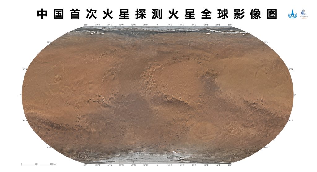
China releases first color-coded global map of Mars

Beijing, The Gulf Observer: China released its first color-coded global map of Mars on April 24, to coincide with the Space Day of China 2023. Its 76-meter spatial resolution provides better quality for conducting future Martian exploration projects and scientific research.
The colored map images were jointly released by China National Space Administration (CNSA) and the Chinese Academy of Sciences (CAS) at a launch ceremony held in Hefei, east China’s Anhui Province.
The colored images, along with scientific data obtained by the Tianwen-1 Mars mission, will be conducive to deepening our understanding of the Red Planet.
The medium-resolution camera of the orbiter of the Tianwen-1 mission carried out 284 orbital remote sensing imaging from November 2021 to July 2022, providing coverage of the entire Martian surface. The ground application system processed 14,757 image data to obtain the colored map images of the planet Mars.
Through these high-resolution images of Mars, researchers have identified a large number of geographic entities, 22 of which were named after historical and cultural villages and towns in China with a population of less than 100,000 by the International Astronomical Union (IAU) based on relevant rules.


