Philippine Space Agency Partners with University of Antique to Boost Disaster Resilience and Agricultural Productivity
Antique, The Gulf Observer: The Philippine Space Agency (PhilSA) has announced a strategic collaboration with the University of Antique (UA) aimed at enhancing disaster preparedness and improving agricultural productivity in the province of Antique, which is highly vulnerable to natural calamities.
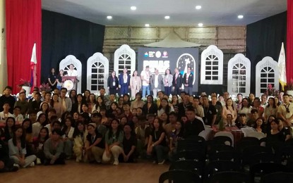
PhilSA Space Science and Technology Deputy Director General Dr. Gay Jane Perez revealed the partnership during the ongoing PhilSA Integrated Network for Space-Enabled Actions towards Sustainability (PINAS) workshop, being held from July 2 to 3 at UA’s main campus in Sibalom.
“We are working closely with the University of Antique through this PINAS workshop, as the university will play a crucial role in collecting ground data, which will be validated with our satellite data,” said Dr. Perez.
The collaboration focuses on data sharing and joint analysis for environmental monitoring and agricultural applications. Perez also confirmed that PhilSA is preparing to formalize this partnership through a Memorandum of Agreement (MOA) with UA by the end of 2025.
Under Republic Act 11363, known as the Philippine Space Act, PhilSA leads the country’s national space program, using satellite technology to support disaster management, environmental protection, and sustainable development.
“Satellite-derived maps allow us to monitor environmental conditions, identify flood-prone areas, and assess the impacts of El Niño and other calamities,” Perez explained. Such data empowers local government units (LGUs) to issue early warnings, assess disaster impacts, and guide recovery efforts.
As part of the initiative, UA will receive 1,400 digital maps documenting historical incidents, which can be overlaid with new data for comprehensive analysis. The two-day workshop also covers space data dashboards, drone applications, and image processing to help LGUs, civil society, and researchers access and utilize satellite data effectively.
The collaboration extends to agricultural applications, such as monitoring bamboo plantations to mitigate flooding and protect agricultural productivity.
Antique Representative Antonio Agapito Legarda welcomed the initiative, emphasizing its life-saving potential. “The satellite data from PhilSA can help us protect lives, properties, and communities. This workshop prepares us for future calamities,” he stated.
UA officials also expressed optimism about the partnership. Dr. Jelyn Alentajan, UA Vice President for Research, Extension, and Innovation, remarked, “The Yamang Kalawakan (wealth from space) will also become the wealth of Antique.”
UA President Pablo Crespo Jr. affirmed that this collaboration will serve the best interests of the province, enhancing resilience and sustainable development efforts for Antique’s communities.